SOUTHERN COLORADO- Water supply conditions across Colorado continue to be highly variable this year but have led to below average water supply forecasts across all major basins. The warm and dry conditions of last summer are rolling over into 2021.
Dry soils resulting from the ongoing drought have impacted how snowmelt transitions into streamflow runoff. Compared to similar snow accumulation years, the dry soils and antecedent drought conditions substantially reduce the amount of water entering stream channels.
In addition to soil moisture and other environmental conditions, the other lingering effect of the ongoing drought is reservoir storage in parts of the state that have remained the driest, particularly in southwest Colorado.
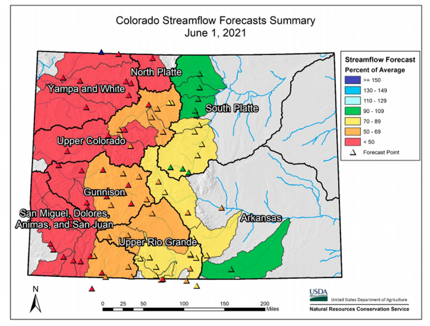
Water supply forecasts for total volume of April-July streamflow range from a low of 26%t of average on the combined Yampa-White River basins to a high of 95% of average in the South Platte, with most of Western Colorado being near to below 50 percent of average streamflows.
As in any year, future temperature and precipitation patterns can still change a lot, but at this point in the runoff season it is vital to continue to keep a close watch on streamflows, reservoir storage, and overall changing water supply conditions across the state.
Snowpack conditions
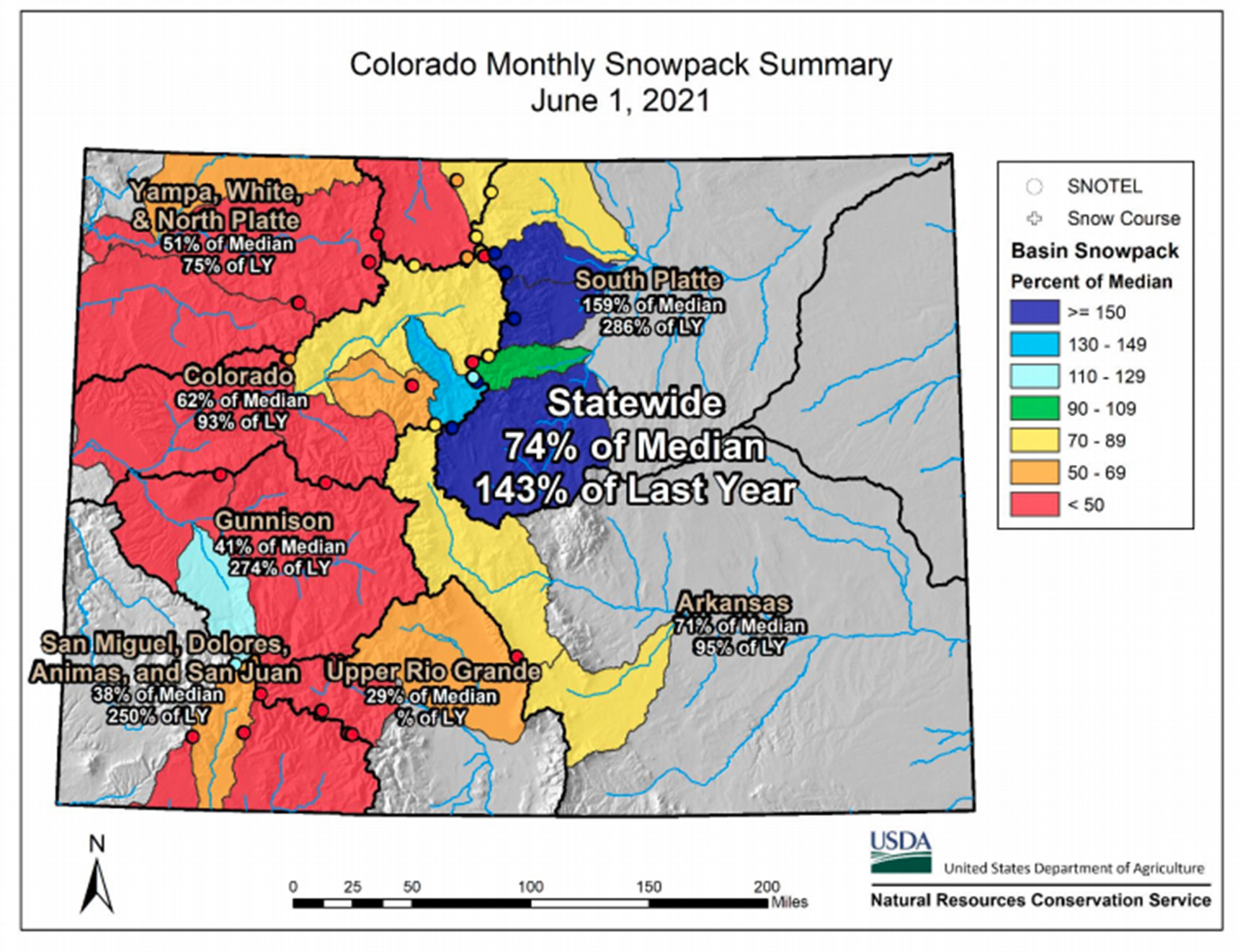 Snowpack across much of the state has diminished rapidly due to above average temperatures and below normal snowfall. Statewide snowpack is currently 74% of median and every major basin currently has a below normal snowpack, except for the South Platte river basin. As of June 1st, 63% of all SNOTEL stations across Colorado have fully melted out.
The stations that have melted out are scattered across the state at different elevations and aspects, but the majority are in the southern mountains. These southern river basins experienced less snowfall and warmer temperatures, resulting in faster snowmelt rates.
 The South Platte river basin benefited the most from these storms and currently has 159% of median snowpack. Lastly, the Arkansas river basin is currently 71% of median.
The South Platte, Arkansas and Upper Rio Grande river basins all received above average precipitation during May at 130, 154 and 162% of average precipitation, respectively.
Although the month of May brought helpful moisture statewide, the precipitation for the water year remains below average for every major river basin in Colorado.
As of June 1, the South Platte and Arkansas river basin has the highest percent of average water year-to-date precipitation, which is 98% and 92% of average, respectively.
Arkansas River basin synopsis
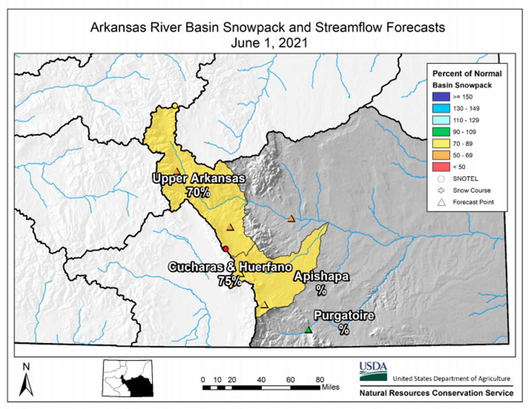 Snowpack in the Arkansas river basin is below normal at 71% of median. Precipitation for May was 154% of average which brings water year-to-date precipitation to 92% of average. Reservoir storage at the end of May was 74% of average compared to 87% last year. Current June – July streamflow forecasts range from 92% of average on the Cucharas River near La Veta to 51% of average on the Chalk Creek near Nathrop.